Circumnavigating Kananaskis Country’s Tombstone Mountain

I should have paid closer attention to the details.

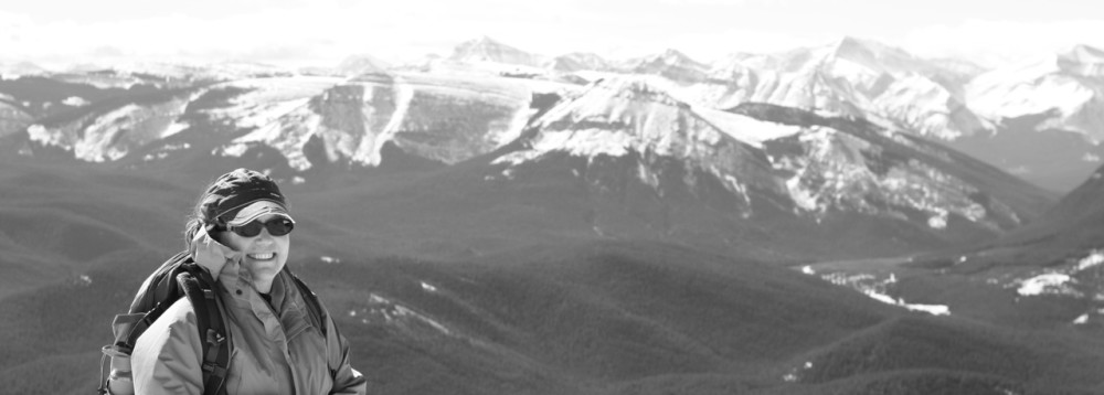
We shouldered our backpacks in the Elbow Lake parking lot on Highway 40 in Peter Lougheed Provincial Park, Alberta, and joined the day hikers heading for Rae Glacier and the young families traipsing up to the lake. The short 1.3 km uphill was quickly covered and we left most of the crowd behind to head out alongside the headwaters of the Elbow River towards the Piper Meadows turnoff at 3.8 km from the lake.

Looking at the topographic map, we saw the “shortcut” across the meadows. The main turnoff was less than a km down the trail, but why go downhill, just to climb back up again? Why not take the direct route and save a little time and effort?

You know where this is going, right?

After a little cursing and more bushwhacking, we came up on the trail. No time or effort saved; probably the reason Gillean Daffern didn’t mention the “shortcut” in her guidebook. Happy to have a trail once again under our feet, we ambled through the forest, steadily climbing to Piper Meadows in full bloom.

Wildlfowers in full bloom on the approach to the meadows below Piper Pass. (Photo: M. Kopp)

Wildlflowers on the approach to the meadows below Piper Pass. (Photo: Megan Kopp)

A single Bighorn sheep skittered off to the scree slopes as we entered the meadows and old bear diggings marked the search for juicy roots as we got closer to the pass. What looked like uniform, fine brown dirt from a distance turned out to be slippery and steep scree up to the pass. The views back towards Rae Glacier took some of the sting out of the effort.

Climb, climb, climb up to the pass. (Photo: B. Kopp)

Climb, climb, climb up to the pass. (Photo: Brad Kopp)

Layers, snacks and drinks took precedence at the pass (5 km from the Big Elbow trail junction). Piper Pass was named in honour of Norma Piper, an opera singer who married local legend George Pocaterra in the 1930s.

At the pass overlooking the route down the West Fork. (Photo: M. Kopp)

At the pass overlooking the route down the West Fork. (Photo: Megan Kopp)

Looking over the other side towards the small tarn that was our original destination for the evening, I almost gasped at the faint trail – I swear made by the shaggy sheep that was looking up curiously at us. Had I been paying closer attention earlier, I might have heard “cliffs and vertiginous scree slopes” and “for experienced scree bashers and route-finders only.”

The descent off Piper Pass is challenging with loose scree and next to no trail. (Photo: M. Kopp)

The descent off Piper Pass is challenging with loose scree and next to no trail. (Photo: Megan Kopp)

Ankles and knees still operating at almost full capacity, we stopped at the tarn and assessed the weather. The warm, sunny summer’s day was turning cloudy and without a doubt a storm was going to hit. The small alpine meadows offered little protection and we agreed it would be best to head for the shelter trees near the valley bottom. This is where it turned ugly… the route that is, not the surroundings!

Side-hilling across grassy meadows on the right and descending through some blocky scree we eventually reached the avalanche paths mentioned in the guide, hoping to see a sign of a trail. There really wasn’t one. Pushing on in the direction we knew we had to go, we bashed through the trees and finally found a bit of a route… oh, lost it… there it is… no, it’s gone again.

Finally on the "trail" - West Fork is a test of route finding skills. (Photo: B. Kopp)

Finally on the “trail” –  the West Fork of the Little Elbow is a test of route finding skills. (Photo: Brad Kopp)

By the time we reached the small canyon, a fairly well-defined trail led us down to an old hunter’s campsite beneath a towering ribbon waterfall. Perfect place to pitch a tent and hang a cooking tarp – all accomplished just before the rain set in for the night.

The problem with rainy nights and bushy trails is that no matter how waterproof your boots are or how high the gaiters rise, you are going to get wet. Especially when the trail disappears from time to time beneath the ravages of the 2013 floods. We kept heading downstream and angled across the wide meadows until we intersected the trail.

Moist meadow walking. (Photo: M. Kopp)

Moist meadow walking – yes, there is a trail here! (Photo: Megan Kopp)

At this point, I’m really not sure why I bothered taking off my boots for the first of four creek crossings for the day, but damp is different than soaking wet. On the creek bank, fresh wolf tracks were spotted in the mud.

Glacial creek crossings are part of the adventure. (Photo: M. Kopp)

Glacial creek crossings are part of the adventure. (Photo: Brad Kopp)

It was a challenging 3.5 km from our camp to the end of the exploration road where the route heads up to Paradise Pass. With clouds threatening, we made a hasty route change and opted for the easier hike 4.9 km down to Romulus Campground, up towards Tombstone Pass and back around to Elbow Lake rather than heading over Paradise and out Evan-Thomas as originally planned.

Spending another night down the trail from the pass, we took the side route in the morning into Tombstone Lakes. So close to Piper Pass and yet, so far.

Lower Tombstone Lake - Piper Pass is right on the other side of those rocks! (Photo: M. Kopp)

Lower Tombstone Lake – Piper Pass is just on the other side of those rocks! (Photo: Megan Kopp)

Yes, I probably should have paid closer attention to the route details before heading out on this adventure, but if I had, I might have objected and missed the chance to circumnavigate Tombstone Mountain – and the opportunity to savour this little slice of heaven.

Total distance travelled: ~39 km
Guidebook: Daffern, Gillean. Kananaskis Country Trail Guide, Volume 2, 4th ed. Rocky Mountain Books, 2011.

Springtime in the Foothills of the Canadian Rockies

How do I know spring is here?

It’s the tired pup in the back of the car at the end of a warm hike up Prairie Mountain, outside of Bragg Creek (just west of Calgary, Alberta).

Taylor in the boot - of the car! (Photo credit: M. Kopp)

Taylor in the boot – of the car! (Photo credit: M. Kopp)

The flowers are starting to show their glorious colour!

Prairie crocus - one day out! (Photo credit: M. Kopp)

Prairie crocus – one day out! (Photo credit: M. Kopp)

I’m playing pickup on the river as my guy and his friends come down the Bow River from Ghost Dam with huge smiles on their faces.

Shuttle pickup for my kayaker and his pals on the Bow River. (Photo credit: M, Kopp)

Shuttle pickup for my kayaker and his pals on the Bow River. (Photo credit: M, Kopp)

“Spring work is going on with joyful enthusiasm.”
― John MuirThe Wilderness World of John Muir

Snagmore Trail

What’s in a name? Inspiration – perhaps!

Snagmore – snag more time outdoors. That’s what I did this weekend.

Overlooking the Elbow River from Snagmore Trail. (Photo Credit: M. Kopp)

Overlooking the Elbow River from Snagmore Trail. (Photo Credit: M. Kopp)

Snagmore is one of the dozens of new trails that have been developed within the West Bragg Trail System in Kananaskis Country just west of Calgary, Alberta in the past few years. Built as a mountain bike trail, it’s still multi-use and the winter hiking options are brilliant.

Spending time outdoors feeds the soul – and for that reason, alone, I’d like to thank the volunteers who maintain this network of trails.

Thanks!

Did You Know?
The Great Bragg Creek Trails Association (GBCTA) is a volunteer organization designing, building and maintaining trails in the area. They groom winter cross country ski trails; build mountain biking routes; and maintain trails – such as Snagmore.

P.S. GBCTA is always looking for extra hands to help with special projects.


.


Winter Hiking: Alberta’s Boom Lake

We had to search farther afield than normal – heading out near Lake Louise – to find winter for a mid-week nature fix. But when skis skitter, clatter and refuse to obey direction, I’m more than happy to swap out skinny skis for the hiking boots and ice grips my guy had the foresight to pack. It’s been a strangely warm winter. Recent rain turned the trail rock hard. Winter hiking never looked so good!

Boom Creek running free mid-February is a sure sign of a warm winter! (Photo Credit: M. Kopp)

Boom Creek almost ice-free in February is a sure sign of a warm winter! (Photo Credit: M. Kopp)

Close to the Continental Divide, Boom Lake trail is an easy 5 km (3 mi), gentle jaunt uphill through a thick evergreen forest. Total elevation gain is only 175 m/575 ft, but the resulting lake view is worthy of much steeper ascents.

Soaking up the views at Boom Lake. (Photo credit: M. Kopp)

Soaking up the views at Boom Lake. (Photo credit: M. Kopp)

If You Go:
The trailhead can be found 7 km (4.3 mi) south of the Trans Canada Hwy (#1) on Hwy 93 (heading towards Radium, BC).

Alberta’s Mountains: They Have a Way of Putting Life into Perspective

There is something about being outside that puts everything in its place. I headed out for a four-day ski trip up the Icefields Parkway in Banff National Park with a mind full of clutter. I came back home with a clean slate, refreshed and relaxed.

Why?

Take a look at the picture below.

Looking across to Bow Summit. (Credit: M. Kopp)

Looking across to Bow Summit. (Credit: M. Kopp)

Did you spot our vehicles parked roadside near the lower meadow?

What are men to rocks and mountains?
― Jane Austen, Pride and Prejudice

One Writer’s Year

I do spend time in the office, it’s just that this writer’s inspiration comes from the outside. So here’s a look back at my muse in 2014.

January

Hold still Frosty, I need a pic for Instagram! (Credit: A. Kopp)

“Hold still Frosty, I need a pic for Instagram!” (Credit: A. Kopp)

February

Escape (Photo: B. Kopp)

An Amiskwi Escape (Photo: B. Kopp)

March

Cruising in San Diego (Credit: B.Kopp)

Cruising in San Diego (Credit: B. Kopp)

April

Heading out on the San Juan River, Utah (Credit: M. Kopp)

Heading out on the San Juan River, Utah (Credit: M. Kopp)

May

Backpacking Grand Gulch, Utah (Credit: B. Kopp)

Backpacking Grand Gulch, Utah (Credit: B. Kopp)

June

Ha Ling Peak, Canmore (Credit: M. Kopp)

Ha Ling Peak, Canmore (Credit: M. Kopp)

July

Forbidden Plateau, Vancouver Island (Credit: M. Kopp)

Forbidden Plateau, Vancouver Island (Credit: M. Kopp)

August

Getting set to backpack into Mt. Robson, BC (Credit: B. Kopp)

Getting set to backpack into Mt. Robson, BC (Credit: B. Kopp)

September

Egypt Lake, BC (Credit: B. Kopp)

Tryst Lake, AB (Credit: B. Kopp)

October

Hiking along the Lycian Way, Turkey. (Credit: B. Kopp)

Hiking along the Lycian Way, Turkey. (Credit: B. Kopp)

November

Wintery walk up Cougar Creek, Canmore (Credit: M. Kopp)

Wintery walk up Cougar Creek, Canmore (Credit: M. Kopp)

December

Bluebird day at Chester Lake. (Credit: B. Kopp)

Bluebird day at Chester Lake, Kananaskis.  (Credit: B. Kopp)


Hiking Black Rock in the Ghost Wilderness

I hadn’t been up Black Rock in the Ghost for over 10 years. And I probably wouldn’t have been this past weekend if fate – and Twitter – hadn’t intervened.

Let me explain.

As a writer, I’m always trying to keep up on social media – making sure I have a presence, build a brand, ya-da ya-da – you know, all those things a writer needs to do in order to stay current. Building up a following means following others and I’ve been selectively finding like-minded people/groups to follow.

Friends of the Ghost was just such a group. I followed them; they followed me back. And then they sent me a note:

Hike? Black Rock? With the Ghost Watershed Alliance Society? On a day with no looming deadlines? I’m in!

Crossing the Ghost! (Credit: M. Kopp)

Crossing the Ghost! (Credit: M. Kopp)

Oh boy, was I in! Beyond a rough gravel road and steep hill to the river valley, access includes glacial river crossings (don’t forget to pack water shoes). The hike itself is a strenous, 900-metre elevation climb with plenty of scree.

(Credit: M. Kopp)

Up, up… oh yeah… and up! (Credit: M. Kopp)

But the views just keep getting better!

(Credit: M. Kopp)

Nearing the summit. (Credit: M. Kopp)

At the summit, the old fire lookout dating back to 1930s stands as a weathered testament to the will of hikers. It’s a little beaten, a little ragged – but still standing!

(Credit: M. Kopp)

Black Rock Fire Lookout. (Credit: M. Kopp)

Thanks Friends of the Ghost, GWAS and Ghost Hikers for the carpool, conversation and company. Brilliant day!

Late day sun turns Black Rock golden. (Credit: M. Kopp)

Late day sun turns Black Rock golden. (Credit: M. Kopp)

Hiking Kananaskis Country: Mustang Hills

Named for the feral horses that roam the front ranges and foothills along the Elbow River, Mustang Hills is a hidden hiking area with spectacular views. Open, grassy slopes offer a panorama of Quirk Ridge, Forgetmenot Ridge, Banded Peak, Outlaw Peak, Mount Cornwall and Mount Glasgow.

Panoramic views from the Mustang Hills. (Photo: M.Kopp)

Panoramic views from the Mustang Hills. (Photo: M.Kopp)

Starting at the parking lot at Cobble Flats, we followed the old highway as it meandered steadily uphill to a cairned path leading through the forest to a large open grassy meadow. At the top end of the meadow, the path continued up through the trees to another old road and a spot that matched the guidebook description.

Quirk Creek behind the hiking hound. (Photo: M.Kopp)

Quirk Creek behind the hiking hound. (Photo: M.Kopp)

From the tattered strip of flagging tape and fallen down cairn, it was easy uphill on a well-defined trail to West, Centre and East Hills. Calypso orchids bloomed in the duff of a pine forest floor. Early blue violets, Jacob’s Ladder, Rock jasmine, and Wild strawberry were in full glory. No visuals on the mustangs, but tracks and droppings everywhere.

Jacob's Ladder in full bloom. (Photo: M. Kopp)

Jacob’s Ladder in full bloom. (Photo: M. Kopp)

The descent to the Elbow River off East Hill is not well used and it is easy to lose the route. We followed flagging tape, blazes and occasional cairns until they disappeared and then just worked our way down the hill until we hit the trail again near a small creek. From here, the route is once again well defined – even with the flood damage of last year.

For a trail description and map, check out the Kanananskis Trails blog.

Coping with Writing Burnout

Three kid’s books deadlines, three travel writing contracts, one freelance travel article, and my biannual, continuing education travel writing course at Mount Royal University – September was fingers to keyboard and focus, focus, focus. The process tapped resources I didn’t know I had, but it left me feeling a little burnt out.

October’s seen this writer back out on the trail. With only a book to review and a small  writing project lined up, I’ve got time to get outside before the snow flies.

Early October near Helen Lake, AB (photo: B.Kopp)

Early October near Helen Lake, AB (photo: B.Kopp)

Or not!

Regardless of the weather, this writer is grateful for the energy that comes from grounding myself in the outdoors. It’s pure, positive, and powerful. Writing blocks crumble, creative thoughts abound, and words flow easily again.

How do you recharge when writing burnout looms?